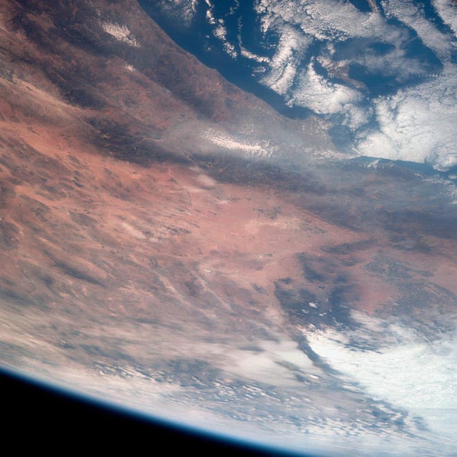
This is a view of Southern California during the Apollo 7 spacecraft’s 18 orbits around the Earth. It was taken on October 12, 1968 from an altitude of 124 nautical miles. The California coast can be seen from Point Mugu south to Oceanside. Santa Catalina is visible below clouds offshore. Details of the Los Angeles area are obscured by pollution that stretches 100 miles west from Banning and beyond Malibu. At the top of the photo are (from left to right) the San Joaquin Valley beyond Bakersfield, the Techapi Mountains, the Sierra Nevada Mountains, Owens Valley, Death Valley, and the Mojave Desert. Created:1968-10-12
Courtesy of NASA

Oblique Earth view taken by the Apollo 9 crew. View of California including Santa Barbara, Los Angeles, San Diego, Santa Rosa, San Miguel, Santa Cruz Islands, Santa Barbara Channel, Salton Sea, Service Module, and Lunar Module Adapter. This image was taken on March 3, 1969.
Courtesy of NASA

Ventura is a coastal city, backed by hills and flanked by two rivers. Archaeologists have found traces of human habitation dating back 10,000 years. When the Spanish arrived in the late 18th century, they found the Chumash and Sisholop villages. In 1782, Junipero Serra established Mission San Buenaventura. Rich farmland and more recent oil discoveries have brought economic growth. In late 2017, the Thomas Fire spread through downtown and nearby communities, eventually burning more than 270,000 acres. This image was taken on April 27, 2016, and the area is 28.8 x 34.1 kilometers, and the location is 34.2 degrees north and 119.1 degrees west.
Courtesy of NASA

This perspective view, obtained by NASA’s Shuttle Radar Topography Mission from data collected on Feb. 16, 2000, shows an area of Ventura County that includes Simi Valley at the center of the image.
Courtesy of NASA/JPL/NIMA

This perspective view, produced using Shuttle Radar Topography Mission data and enhanced Landsat imagery, shows rectangular fields in the heavily agricultural Santa Clara River Valley.
Courtesy of NASA/JPL/NIMA/USGS

This radar image of Ventura County shows the Santa Clara River valley and surrounding mountains. The river valley is a linear feature that stretches from lower right to upper left where it flows into the Pacific Ocean. The image was taken on April 15, 1999.
Courtesy of NASA/JPL

This image shows Ventura, one of the state’s oldest cities, and Lake Casitas. NASA’s Shuttle Radar Topography Mission acquired the data on February 16, 2000.
Courtesy of NASA/JPL/NIMA

Overview of the Los Angeles, California metropolitan area, including the coastline, Vandenberg Air Force Base, the southern edge of the Central Valley, and the dry lake bed at Edwards Air Force Base. Look closely and you can see water in the lake bed at Edwards Air Force Base, which was once used for two shuttle landings. Other cities visible include Oxnard, Santa Barbara, Bakersfield, Vandenberg Air Force Base, and The Ranch. This image was taken on March 30, 1992.
Courtesy of NASA

NASA astronaut and Expedition 69 flight engineer Woody Horberg captured this photo from the International Space Station at an altitude of 262 miles, showing Ventura County on California’s Pacific coast, just north of Los Angeles. The image was taken on April 1, 2023.
Courtesy of NASA


